|
MAIN MENU |
ABOUT CAMBODIA |
RECOMMENDATION |
PHOTO GALLERY |

|

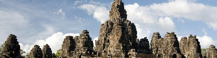
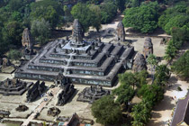
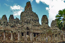
Bayon
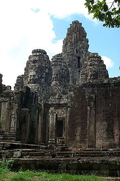
Bayon temple, Angkor Thom
The last temple known to have been constructed in Angkor Thom was Mangalartha, which was dedicated in 1295. Thereafter the existing structures continued to be modified from time to time, but any new creations were in perishable materials and have not survived. In the following centuries Angkor Thom remained the capital of a kingdom in decline until it was abandoned some time prior to 1609, when an early western visitor wrote of an uninhabited city, "as fantastic as the Atlantis of Plato" which some thought to have been built by the Roman emperor Trajan. (Higham 140) It is believed to have sustained a population of 80,000-150,000 people.
Angkor Thom is in the Dom style. This manifests itself in the large scale of the construction, in the widespread use of laterite, in the back-towers at each of the entrances to the south cheack and in the naga-carrying giant monsters which accompany each of the towers.
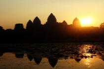
The site
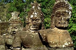
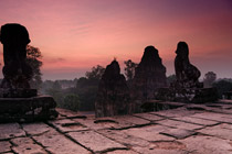
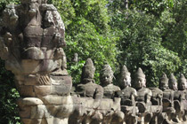
Statues on the bridge leading to Victory Gate, Siem Reap, Cambodia (January 2005).
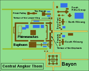
Map of the Central Angkor Thom
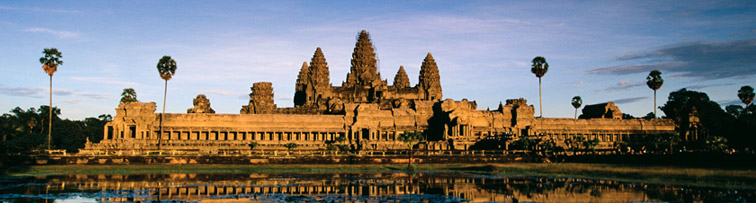
The city lies on the right bank of the Siem Reap River, a tributary of Tonle Sap, about a quarter of a mile from the river. The south gate of Angkor Thom is 7.2 km north of Siem Reap, and 1.7 km north of the entrance to Angkor Wat. The walls, 8 m high and flanked by a moat, are each 3 km long, enclosing an area of 9 km². The walls are of laterite buttressed by earth, with a parapet on the top. There are gates at each of the cardinal points, from which roads lead to the Bayon at the centre of the city. As the Bayon itself has no wall or moat of its own, those of the city are interpreted by archaeologists as representing the mountains and oceans surrounding the Bayon's Mount Meru. (Glaize 81). Another gate — the Victory Gate — is 500 m north of the east gate; the Victory Way runs parallel to the east road to the Victory Square and the Royal Palace north of the Bayon.
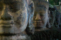
The faces on the 23 m towers at the city gates (which are later additions to the main structure) take after those of the Bayon, and pose the same problems of interpretation. They may represent the king himself, the bodhisattva Avalokiteshvara, guardians of the empire's cardinal points, or some combination of these. A causeway spans the moat in front of each tower: these have a row of devas on the left and asuras on the right, each row holding a naga in the attitude of a tug-of-war. This appears to be a reference to the myth, popular in Angkor, of the Churning of the Sea of Milk. The temple-mountain of the Bayon, or perhaps the gate itself, (Glaize 82) would then be the pivot around which the churning takes place. The nagas may also represent the transition from the world of men to the world of the gods (the Bayon), or be guardian figures. (Freeman and Jacques 76). The gateways themselves are 3.5 by 7 m, and would originally have been closed with wooden doors. (Glaize 82) The south gate is now by far the most often visited, as it is the main entrance to the city for tourists.
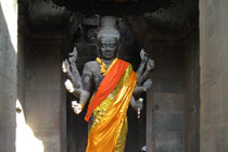
At each corner of the city is a Prasat Chrung — corner shrine — built of sandstone and dedicated to Avalokiteshvara. These are cruciform with a central tower, and orientated towards the east.
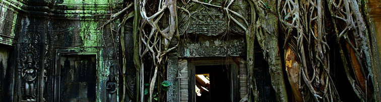
Within the city was a system of canals, through which water flowed from the northeast to the southwest. The bulk of the land enclosed by the walls would have been occupied by the secular buildings of the city, of which nothing remains. This area is now covered by forest.
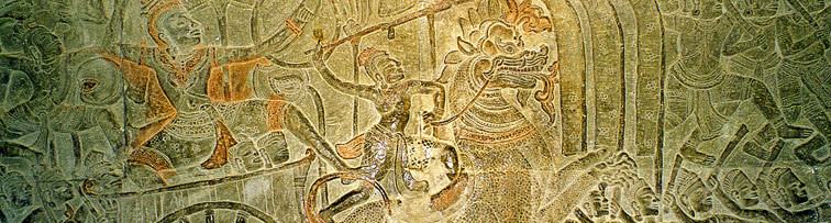
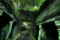
Most of the great Angkor ruins have vast displays of bas-relief depicting the various gods, goddesses, and other-worldly beings from the mythological stories and epic poems of ancient Hinduism (modified by centuries of Buddhism). Mingled with these images are actual known animals, like elephants, snakes, fish, and monkeys, in addition to dragon-like creatures that look like the stylized, elongated serpents (with feet and claws) found in Chinese art.
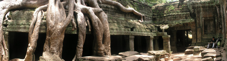
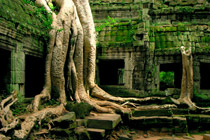
But among the ruins of Ta Prohm, near a huge stone entrance, one can see that the “roundels on pilasters on the south side of the west entrance are unusual in design.”
What one sees are roundels depicting various common animals—pigs, monkeys, water buffaloes, roosters, snakes—and what appears to be a dinosaur! There are no mythological figures among the roundels, so one can reasonably conclude that these figures depict the animals that were commonly seen by the ancient Khmer people in the twelfth century (Jacques/Freeman/Cole).
- Angkor Thom
- Terrace of the Elephants
- Bayon
- Terrace of the Leper King
- Chau Say Tevoda
- Thommanon
- Ta Keo
- Ta Prohm
- Banteay Kdei
- PRASAT KRAVAN TEMPLE
- Pre Rup
- East Mebon
- Ta Som
- Neak Pean
- Preah Khan
- Banteay Samré
- Kbal Spean
- Phnom Kulen
- Beng Mealea
- Preah Ko
- Bakong
- Lolei
Find and Book at our low price
|
 |